20.12
Survey data and more for NZ professionals. In the field and at the desk.
 Google Play
Survey Mark
IS IV DP 543216
832456.195 mN
410876.598 mE
45.66 (NZVD2016)
Capabilities
What the app does
Survey Marks
Every LINZ Mark — Survey and Boundary Marks. Order classification, last survey date, coordinates and more.
NZVD2016 Heights
Orthometric heights on New Zealand's official vertical datum, with a handy green ring for easy identification.
Meridional Circuits
Instant conversion across NZTM2000, geographic, and all 28 Meridional Circuit projections. No tables, no manual arithmetic.
Job Management
Save marks to named jobs and revisit them at the office. Field observations organised by project from the moment you find them.
One-Tap Routing
Turn-by-turn navigation to any mark via Google Maps. Chain multiple marks into a multi-stop route — one tap to go.
Augmented Street View
Survey marks projected onto Street View panoramas using real-world coordinates, terrain height, and tectonic correction.
Navigation
One tap to Google Maps
Save survey marks to a job, then launch turn-by-turn Google Maps navigation directly from the app. Route to a single mark or chain multiple marks into a multi-stop route.
- Single-mark navigation in one tap
- Multi-stop routes chained from saved jobs
- Handoff to Google Maps with waypoints pre-loaded
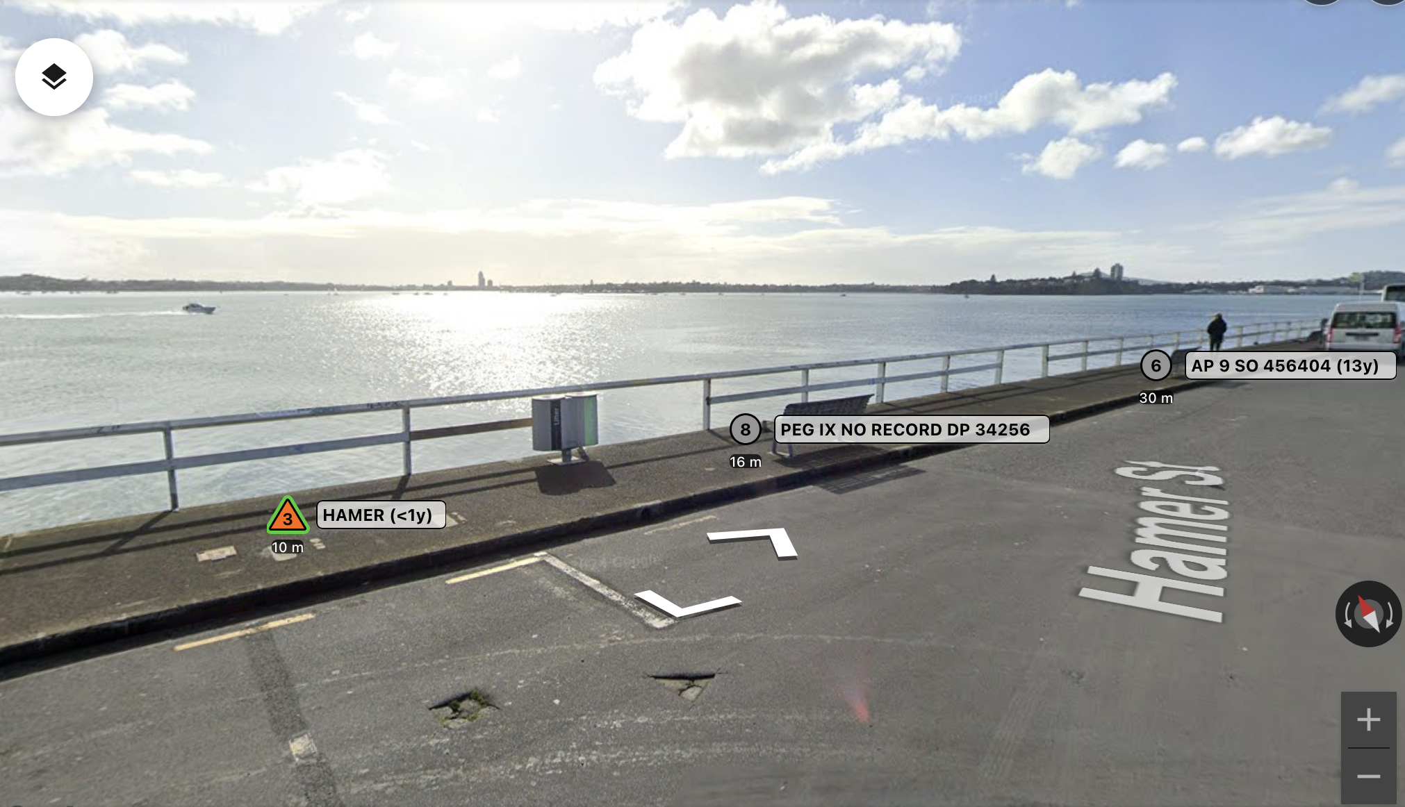
Street View
Survey marks overlaid on Street View
Right-click any point on the map to open an augmented Street View — your survey marks are projected directly onto the panorama using their real order-based symbols. Walk the street and new marks load automatically.
- Marks projected using real-world coordinates
- Tap any mark to open its full detail panel
Support
Get in touch
For support, bug reports, or feature requests about 20.12, reach us directly. We reply to every message.
support@2012.co.nz